
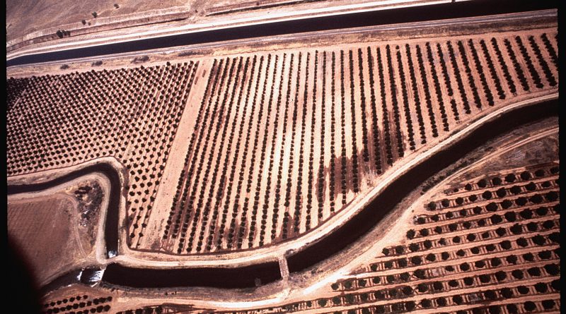
Fresno irrigation canal — Photo: Gene Daniels — Public domain, via Wikimedia Commons
Fresno Engineer Warns Subsidence Could Flood Corcoran During Predicted Strong El Niño
A Fresno civil engineer is warning that land subsidence from groundwater pumping has fundamentally altered the Tulare Lake basin, potentially putting the town of Corcoran and two state prisons at risk of flooding if a predicted strong El Niño develops through spring 2027.
John Ennis, a licensed civil engineer with 33 years of experience, has identified what he calls a nearly 100% correlation between a Relative Oceanic Niño Index of level 2 and flooding on the old Tulare Lake bed. The index currently stands at 1, but the National Oceanic and Atmospheric Administration predicts an 81% chance of a “very strong” El Niño — level 2 or above — persisting through spring 2027.
According to Ennis’ analysis, decades of excessive groundwater pumping have caused subsidence that has “shifted the lake bottom seven miles to the south and east.” He predicts that if Tulare Lake receives 500,000 acre feet of water, Corcoran could be flooded by six to 10 feet of water, including the town’s two state prisons.

An engineering report by Amec Foster Wheeler Environment and Infrastructure Inc. examining subsidence effects near Corcoran found that three separate flood zones appear to be merging, potentially creating a consolidated flood zone that could inundate the California high-speed rail line east of Corcoran in up to 16 feet of water during a major flood.
Steve Haugen, head of the Kings River Water Association, expressed skepticism about the flooding predictions, noting that the 2023 flood brought approximately 580,000 acre feet to the region yet Corcoran stayed dry. However, water did reach the western and southern arms of the Corcoran levee during that event, which had to be quickly rebuilt after sinking due to groundwater pumping.
Land around the Corcoran levee continues to sink. One benchmark site shows 3.96 inches of subsidence just since 2023, while others show between 2.28 and 2.88 inches of continued sinking. The levee itself measured at about 190 to 192 feet elevation as of March.
In 2025, Ennis sent a letter to California Natural Resources Secretary Wade Crowfoot outlining a solution involving permanent water storage on the west side of Tulare Lake. The project would require the state or another entity to acquire land through purchase or eminent domain from major landowners including J.G. Boswell and possibly John Vidovich.
Haugen noted that water management has changed significantly since historical floods, pointing to the Kern River as an example. While the river produced similar volumes in 1983 and 2023 (1,358,664 acre feet versus 1,329,449 acre feet from January to July), it contributed 213,827 acre feet to Tulare Lake in 1983 but zero acre feet in 2023, largely due to increased local recharge infrastructure built to comply with the Sustainable Groundwater Management Act.
Jack Mitchell, head of the Deer Creek Stormwater District, confirmed that subsidence has altered drainage patterns, noting that J.G. Boswell now must pump Deer Creek water uphill into Tulare Lake. “They can’t pump as much water is coming in and that’s what caused a lot of our problems,” Mitchell said.
Mitchell reported that after the 2023 floods, the U.S. Department of Agriculture contacted him about buying 800 acres to absorb Deer Creek flood water, but the department would not fund the construction of containment cells to hold the water, ending the project.
The Breakdown
- A civil engineer has identified a historical pattern linking strong El Niño events (measured by the Relative Oceanic Niño Index at level 2) to flooding on the Tulare Lake bed
- NOAA forecasts an 81% chance of a “very strong” El Niño persisting through spring 2027
- Decades of groundwater pumping have caused the land to sink, shifting the lake bottom seven miles southeast and merging three separate flood zones
- The engineer predicts 500,000 acre feet of water in Tulare Lake could flood Corcoran and its two state prisons by six to 10 feet
- Land around the Corcoran levee continues to sink at rates of 2.28 to 3.96 inches since 2023
- A proposed solution involves building permanent water storage on the west side of Tulare Lake, requiring state acquisition of private land
What This Means for You
If you live in or near Corcoran, the combination of predicted heavy rainfall and ongoing land subsidence from groundwater pumping creates a flooding risk that didn’t exist in previous wet years. The changing landscape means water that once flowed safely through the basin may now pool in populated areas, and local flood protection infrastructure continues to sink even as it’s maintained.