
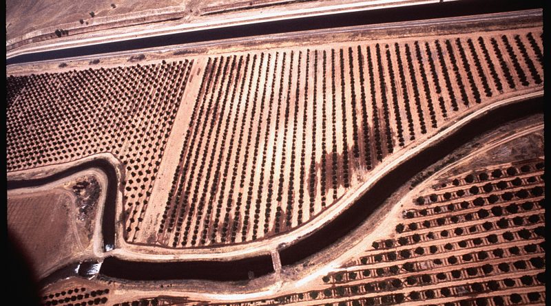
Fresno irrigation canal — Photo: Gene Daniels — Public domain, via Wikimedia Commons
San Joaquin Valley water plan puts $18-33 billion price tag on closing the gap by 2040
The California Water Institute at Fresno State released the Unified Water Plan for the San Joaquin Valley on September 4, the first study to line up water planning across all eight counties in the region — Fresno, Kern, Kings, Madera, Merced, San Joaquin, Stanislaus and Tulare — into a single document. The plan puts the Valley’s water supply-demand gap at roughly 2.4 million to 2.5 million acre-feet annually by 2040 and lays out three investment tiers totaling $18 billion to $33 billion to respond.
Funding for the plan came through the Bureau of Reclamation under Public Law 111-11, the 2009 San Joaquin River Restoration Settlement Act. The money went to Fresno State’s water institute rather than a state agency, with technical modeling by Stantec Consulting Services. The report has been submitted to Congress for reporting to the Senate Committee on Energy and Natural Resources and the House Committee on Natural Resources.
The plan examined more than 80 groundwater sustainability agencies, 42 groundwater sustainability plans, 16 subbasins and about 800 local projects. The Valley stretches roughly 250 miles from Stockton to Bakersfield, forming the southern half of California’s Central Valley. Farming and related industries account for 14 percent of the region’s GDP and 17 percent of its jobs. Fresno, Kern and Tulare counties rank among the nation’s top three agricultural counties by revenue.

The water gap is driven by three factors: compliance with the Sustainable Groundwater Management Act, reduced surface water deliveries, and climate change. Left unaddressed, the plan estimates the gap could take up to a million acres out of production and cost about $7.2 billion in annual farm revenue and 85,000 jobs.
The report ties the current shortage to a loop the Valley has been caught in for decades: less imported water from federal and state canals pushed farmers toward groundwater, groundwater pumping caused the land beneath those canals to sink — a process called subsidence — which damaged the canals and cut their carrying capacity, and repairing the canals is now the precondition for almost everything else in the plan.
Two systems carry most of the imported water the Valley depends on. The federal Central Valley Project, built by the Bureau of Reclamation from the 1930s, moves water south from Shasta and Trinity lakes through the Delta-Mendota Canal to farms on the Valley’s west side, while Friant Dam near Fresno sends water through the Friant-Kern and Madera canals to the east side. The state’s California Aqueduct, part of the State Water Project, runs parallel down the west side and shares San Luis Reservoir with the federal system.
The Department of the Interior announced $540 million for Valley canal repairs in March, including $235 million for the Delta-Mendota Canal specifically. That work is already partly underway.
Even at the top tier of investment, the water gap is not fully closed. The plan is explicit that some farmland retirement — an estimated 400,000 acres under a managed approach — will still be necessary. The plan also calls for coordinated land transition planning that considers environmental, community and economic outcomes.
The report notes that state and federal funding and partnerships with urban entities may be needed to advance projects, identifying affordability as a significant implementation constraint. Neither the Bureau of Reclamation nor Congress is obligated to fund the projects the plan lists. The sixteen individually adopted Groundwater Sustainability Plans the report draws on remain the legally binding documents, enforced independently by the state’s Department of Water Resources and State Water Resources Control Board.
The plan’s role is to line them up into one shared picture and offer it to the state’s own planning process, including the California Water Plan 2028 that Governor Gavin Newsom launched earlier this year with a first-ever statewide supply target of 9 million acre-feet by 2040.
“We are at a defining moment for the San Joaquin Valley,” said Laura Ramos, director of the California Water Institute. “The Unified Water Plan provides a practical framework for moving from fragmented project lists to coordinated implementation that supports communities, agriculture, ecosystems and long-term regional resilience.”
“Every community in this Valley has a stake in water and every community’s plan is in this document,” said Eddie Ocampo, chairman of the Water Blueprint for the San Joaquin Valley. “For the first time, we can show state and federal partners exactly what the Valley needs, in one voice.”
The Breakdown
- The plan catalogs more than 500 individual projects with cost and yield estimates attached, evaluating three broad strategies: restoring the capacity of existing water infrastructure damaged by land subsidence, improving management of water supplies within the Valley, and increasing access to Sacramento-San Joaquin Delta water.
- The report finds that restoring existing infrastructure capacity is necessary to preserve baseline water deliveries and support local and regional projects.
- The analysis concludes that local projects alone will not be sufficient to address the projected long-term gap and identifies additional access to Delta supplies as part of the regional strategy.
- Implementation will depend on water availability, permitting, economic feasibility, funding, partnerships and local capacity.
- Every county in the Valley has a poverty rate above the state average, which is part of why the plan treats drinking water access, not just irrigation supply, as central to its case.
What This Means for You
The officials you elect at the state and federal level — your representatives in Congress, your state legislators, the Governor — will decide whether to fund the infrastructure repairs, groundwater recharge projects, and Delta access improvements this plan catalogs, and how much farmland retirement the Valley faces as a result. The Sustainable Groundwater Management Act, passed by the state legislature in 2014, set the deadline driving this timeline. The report has been submitted to Congress; a public process to decide which projects move first is still to come. How much of the $18-33 billion price tag your representatives are willing to commit, and whether they prioritize canal repairs and local projects over forcing land out of production, will shape both the Valley’s agricultural economy and its drinking water access for decades.
What to Watch
The plan puts a managed farmland retirement figure at 400,000 acres even with full investment — but the report itself notes that implementation depends on funding, permitting, partnerships, and local capacity, variables that are not guaranteed. What happens if the state and federal funding the plan identifies as necessary doesn’t materialize at the scale or speed required? The unmanaged version of farmland retirement — market-driven, concentrated in the most vulnerable communities — is the one with the worst outcomes for drinking water, jobs, and tax base. This is a $33 billion ask with no obligation attached. The question is whether the elected officials who control that funding treat the Valley’s water crisis as urgent enough to act on, or as someone else’s problem to manage.
The plan also identifies increasing access to Delta water as part of the regional strategy, after concluding local projects alone won’t close the gap. That puts the Valley’s needs in direct tension with Delta ecosystem protections and with urban water agencies further south — a fight that has repeatedly stalled in the legislature and in court. Whose water claim wins when they can’t all be met is a political decision, not a technical one, and this plan is an opening bid in that fight, not a resolution.